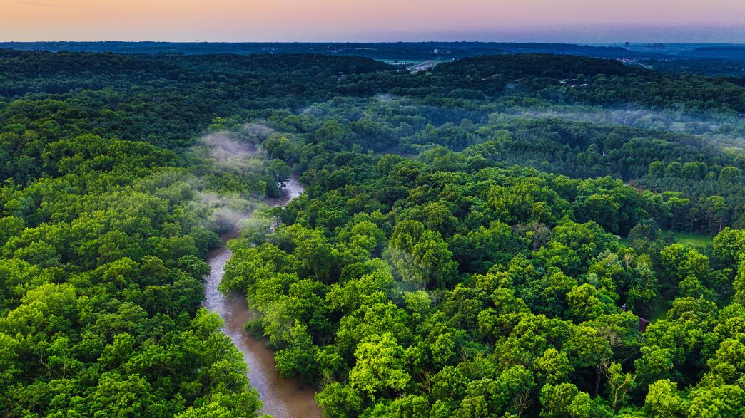
Some wildfires are large enough and hot enough to create their own weather systems.
Scientists estimate that tens to hundreds of storms created by these blazes occur around the world each year. The trend of increasingly severe fires, fuelled by climate change, means that the number is likely to grow.
These wildfire-born storms are becoming a growing part of fire seasons around the world with lasting impacts on air quality, weather and climate. They also make wildfires extremely hot and chaotic, wreaking havoc on firefighting strategies.
Until now, experts have struggled to reproduce this weather phenomenon in their models. But a new study, published in Geophysical Research Letters, has provided a breakthrough which could help predict them and understand what impact they have on the global climate.
How does a wildfire create its own weather system?
Burning vegetation heats the air near the ground, which then rises. Cooler air rushes in to fill the void left by the rising air, generating wind patterns.
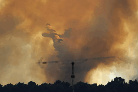
When the conditions are right, the wildfire’s rapidly rising plumes of hot smoke and air cool to form a cloud, known as a pyrocumulonimbus or “pyroCBs”. NASA scientists have referred to them as the “fire-breathing dragon of clouds”.
If enough energy is released and the updraft intensifies, it creates a thunderstorm that is capable of producing downdrafts that spread the flames and dangerous lightning that can ignite new fires.
They can produce dry storms with lightning that strikes without bringing significant rain, making them particularly dangerous as there’s no precipitation to help extinguish blazes sparked by the lightning strikes.
Eventually, this thunderstorm will begin to die, and what goes up must come down. Downdrafts created by the decaying storm can create erratic winds near the ground that spread the fire in ways that are difficult to predict.
Wildfire thunderstorms can have deadly consequences
In 2020, California’s Creek wildfire was so intense that it started to produce its own weather system. Extreme heat from the blaze created a thunderhead – a cumulonimbus cloud that forms before a thunderstorm. This endangered firefighters and made containment elusive as lightning strikes rained down and winds fanned the roaring flames.
Pedrógão Grande, a small municipality in central Portugal, faced a similar scenario in 2017. A huge plume of smoke from a wildfire grew until thunder clouds began forming high up in the atmosphere. It was one of the first recorded pyrocumulonimbus in Western Europe.
The fires in Pedrógão Grande killed 66 people and injured 250 others. An estimated 24,000 hectares of land were burned, and more than 500 houses were partially or totally destroyed over five days.
A world-first breakthrough
In a brand new study, scientists have successfully reproduced the timing, height and strength of the thunderhead seen during the Creek Fire – one of the largest pyrocumulonimbus clouds seen in the US, according to NASA. Their models also replicated the multiple thunderstorms produced by California’s 2021 Dixie Fire, which occurred under very different circumstances.
“This work is a first-of-its-kind breakthrough in Earth system modelling,” according to lead scientist Ziming Ke from the Desert Research Institute in Nevada, US.
Ke adds that this “breakthrough” could improve national resilience and preparedness as scientists are better able to predict these storms. It may also help us to understand what impact they have on a global scale.
When a pyrocumulonimbus cloud forms, it injects smoke and moisture into the upper atmosphere at levels similar to a small volcanic eruption. This impacts the way Earth’s atmosphere receives and reflects light, with pollution from fires persisting for months or longer. If this is transported to polar regions, it could accelerate ice and snow melt.
With wildfire seasons intensifying globally, the ability to predict and understand these fire-generated storms may prove crucial in protecting both lives and the planet’s climate systems.